

Desert Scramble - Part 2

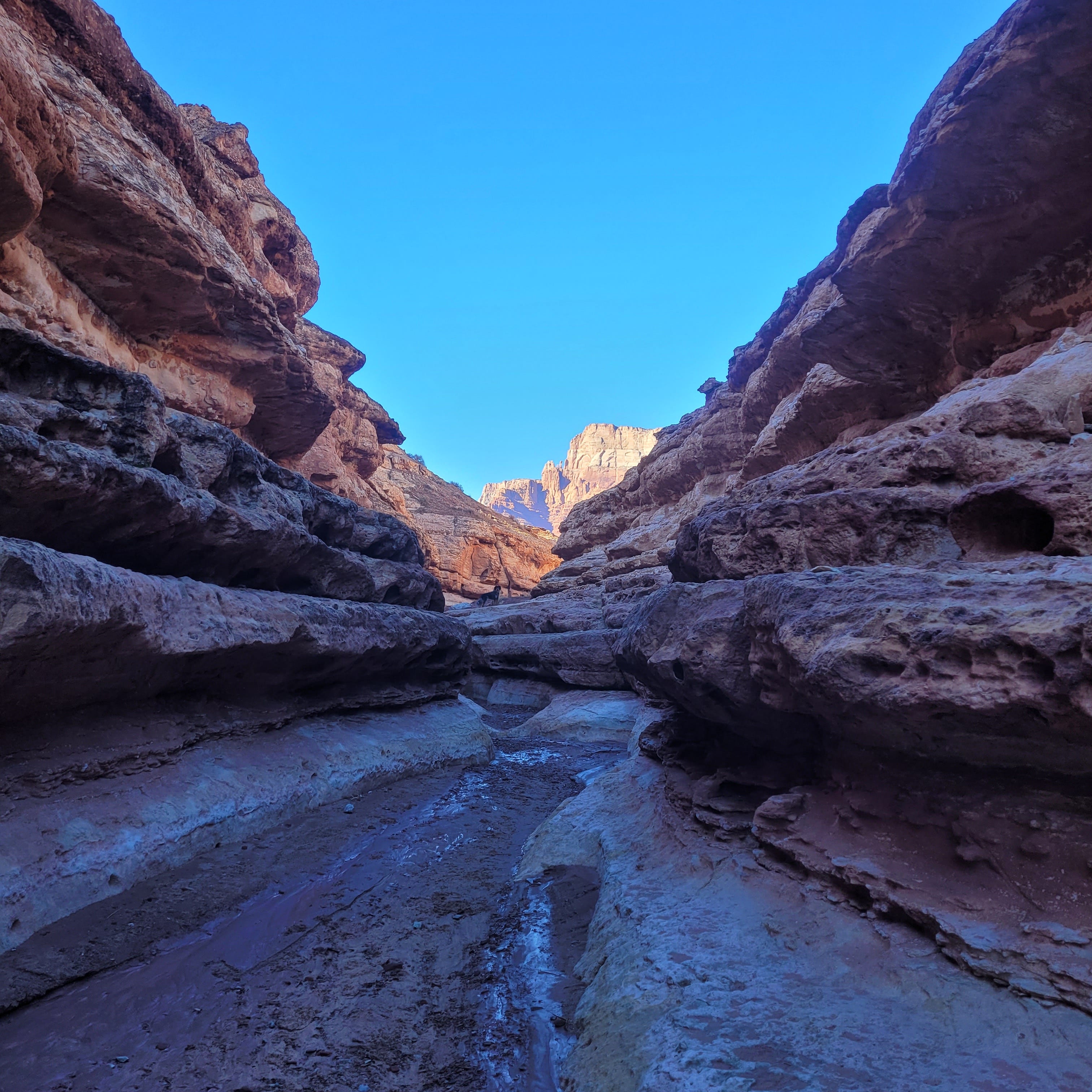
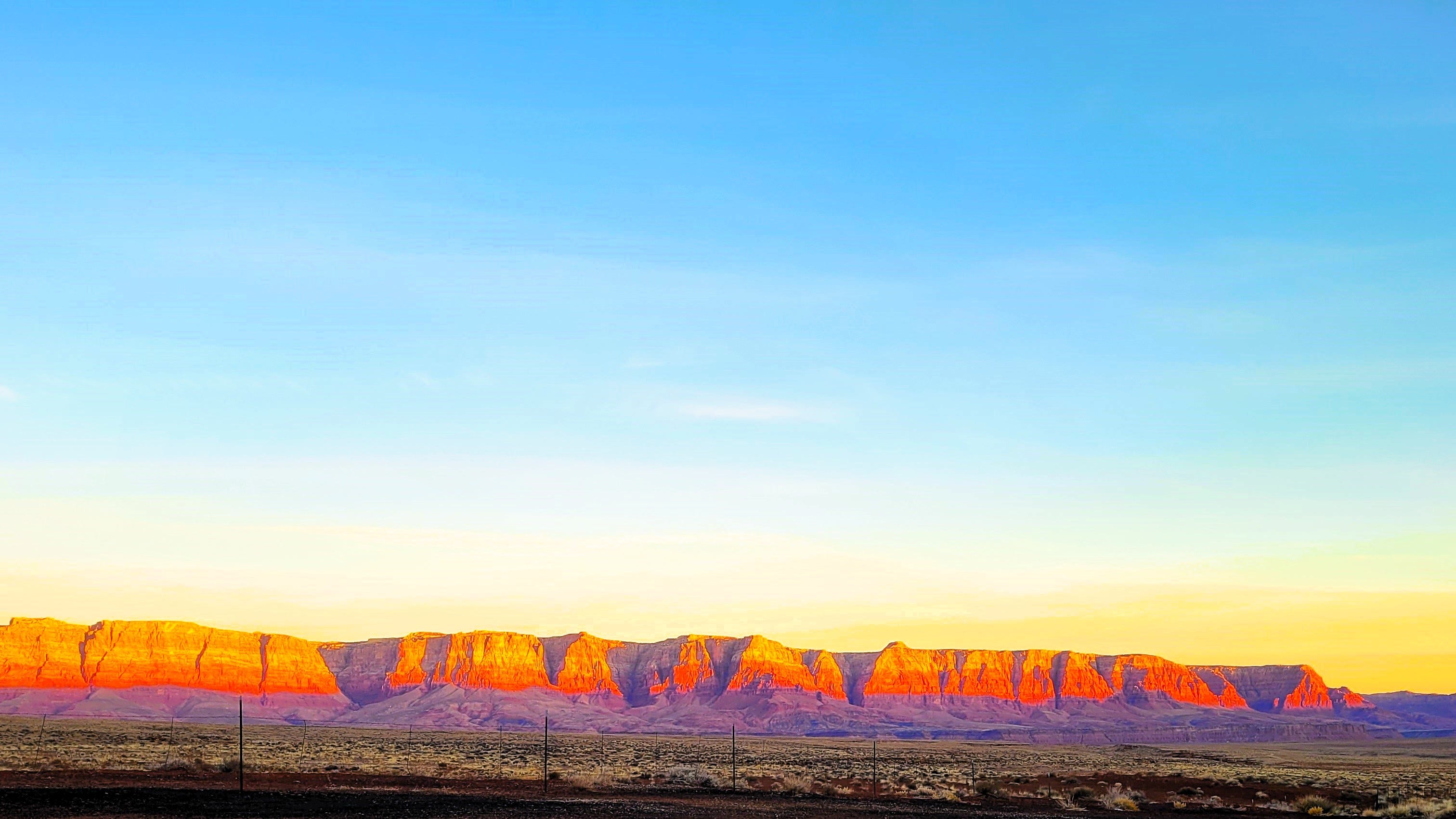
Cathedral Wash is just off the access road to Lees Ferry in northern Arizona. If you zoom in on the picture above, you might see Miss Echo Marie Cortez on point. A few days after a winter storm, the wash still has pockets of muddy water. The floor is wet with splotches of sticky red mud. Echo is wet, filthy, and very happy.
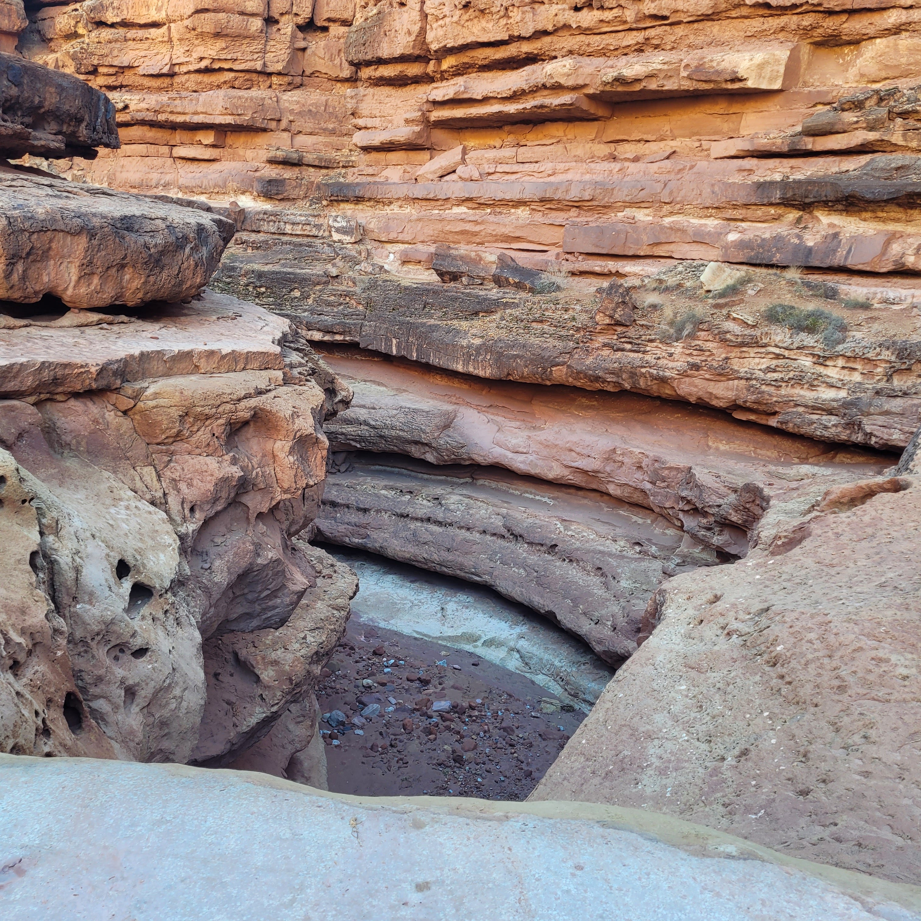
Water, as it sluices its way through sandstone to the river, doesn't flow in an organized and orderly manner. No, it joyously bounces along, carrying rocks and sticks, builds dams, breaks them down, boils over truck-size boulders, and launches willy-nilly over twenty-foot drops.
Once, when we were hiking years ago in the Superstition Wilderness, a thunderstorm up country unleashed a torrent of muddy sludge our way. It came down the wash just a few inches thick but growing. Rocks, branches, and sand burbled and tumbled in the front wave. We took refuge on a high bank and watched the thing grow several feet thick, rumbling and clackity-clacking. Not a drop of rain had fallen on our heads.
No worries about flash flooding this day in Cathedral, Wash. The sky is cobalt blue and crystal clear. A hard edge in the cold morning sky outlines the cliffs.
Two miles down the twisting, layered wash, we come to a twenty-foot dry waterfall with a pool at the bottom. I see no safe way to negotiate the drop, though Echo thinks there could be a route to the right. We turn back and return to the trailhead…sweaty and refreshed.
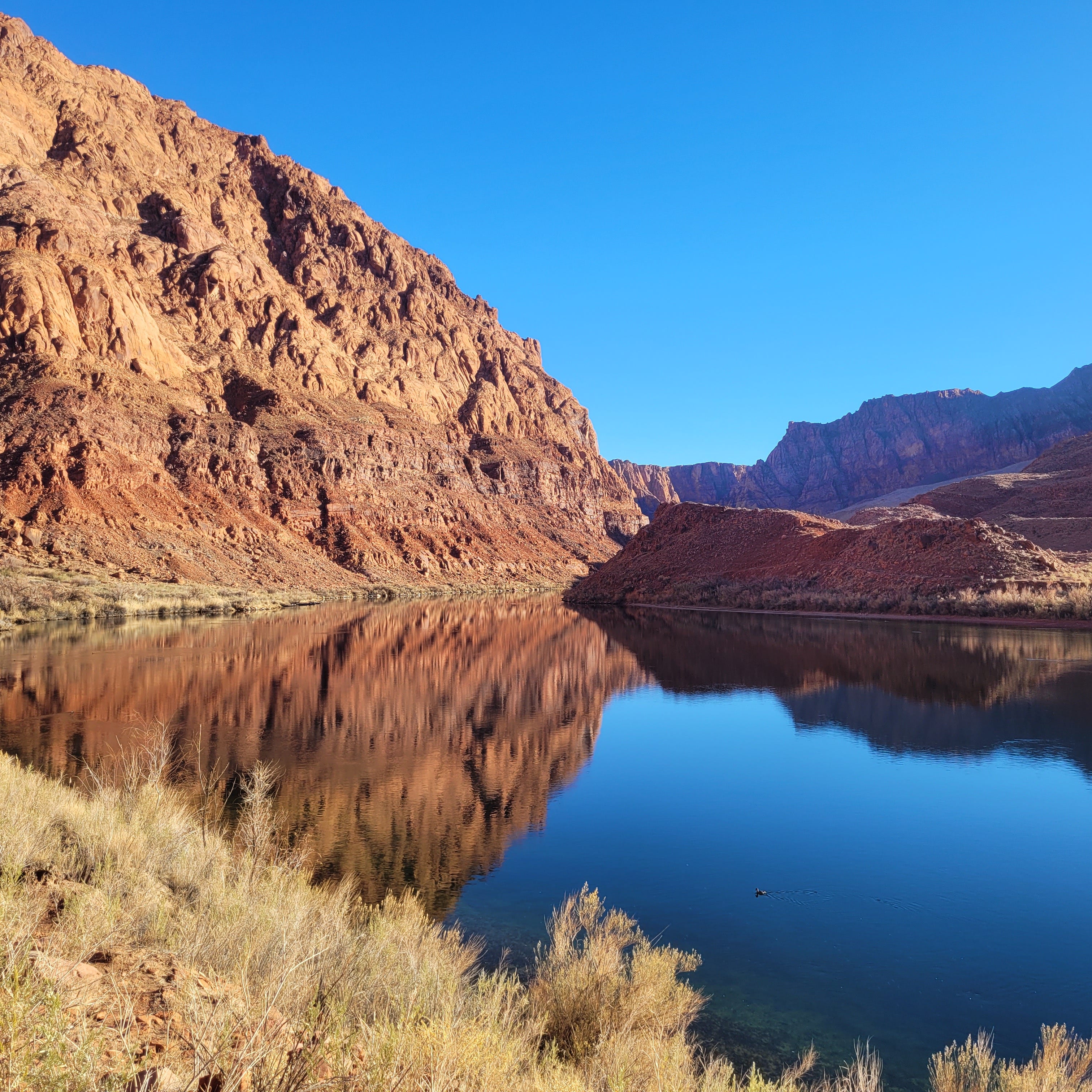
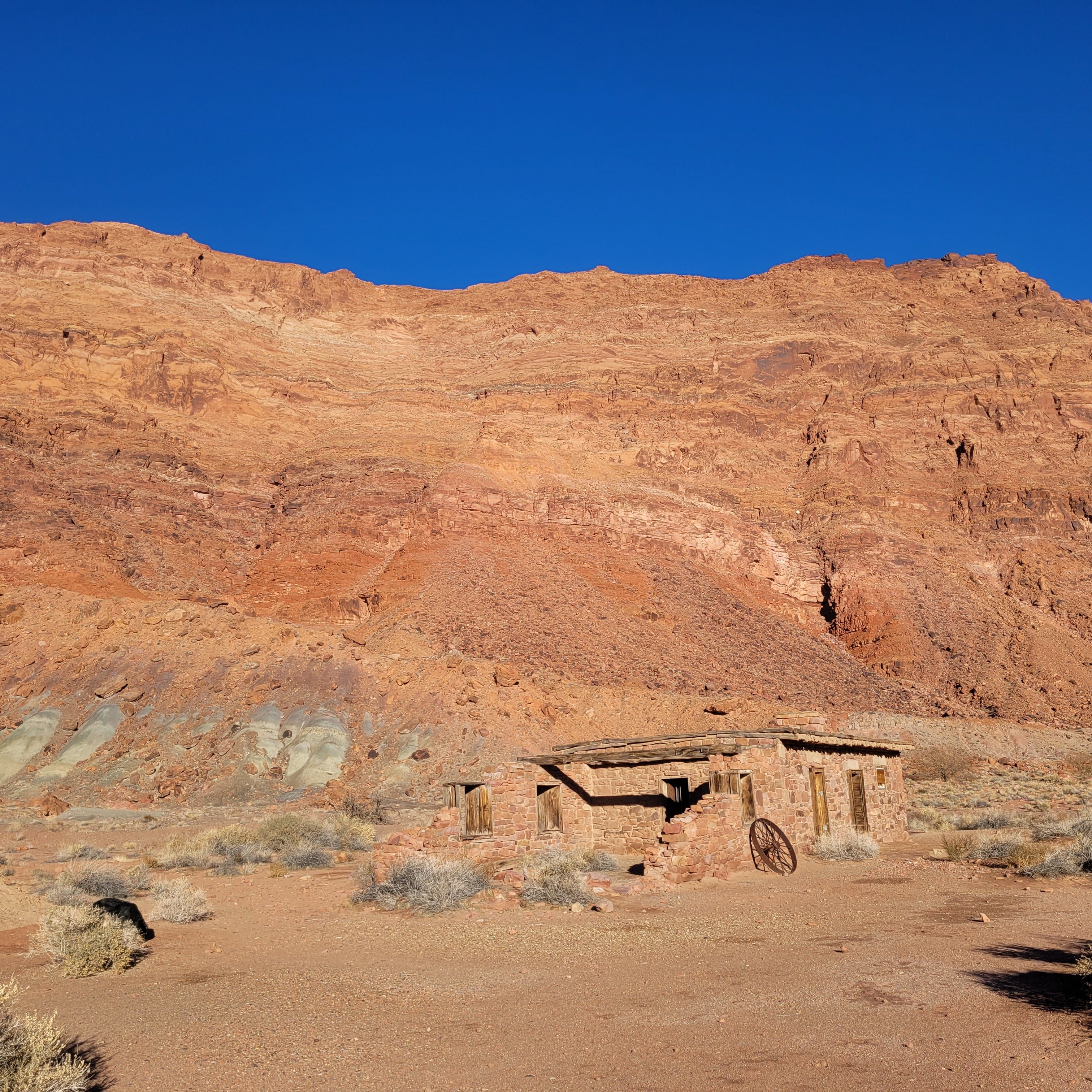
At the end of the access road is Lees Ferry proper. Here, in 1870, John D Lee operated a rudimentary ferry - the only crossing of the Colorado River for 600 miles. It is about fifteen twisty river miles downstream from the atrocious Glen Canyon Dam and its putrid reservoir. The river is a slow, vast, deep, clear, cold water pool here. Lee built a ranch - The Lonely Dell - a quarter mile up a side canyon, irrigated by the desultory flow from the Paria River. Sound Mormon pioneer that he was, he raised a family - nineteen wives and fifty-six children - grew hay and hosted travelers. He was also executed for murder by firing squad - but that's a story for another day. We strolled past his cabins, orchards, and hay fields gone to scrub and wandered up Paria Canyon.
The canyon is flat and wide for a few miles, and the river bed snakes back and forth, edged by willows and cottonwoods. Where we must ford the river, I call a halt, sit against a tree, and listen to…nothing. It's mid-day, sunshine, about 50 degrees. The river quietly flows twenty feet below. Echo negotiates the bluff and dips her belly in the cool wet - laps till she's full, snout dripping.
Upriver is a paradise of over one hundred thousand acres of protected wilderness full of towering sandstone walls, astonishing arches, amphitheaters, terraces, and hanging gardens. There are slot canyons, petroglyphs, deer, and bighorn sheep. Someday…
After moments of bliss, I hoist myself upright and float downstream to the truck.
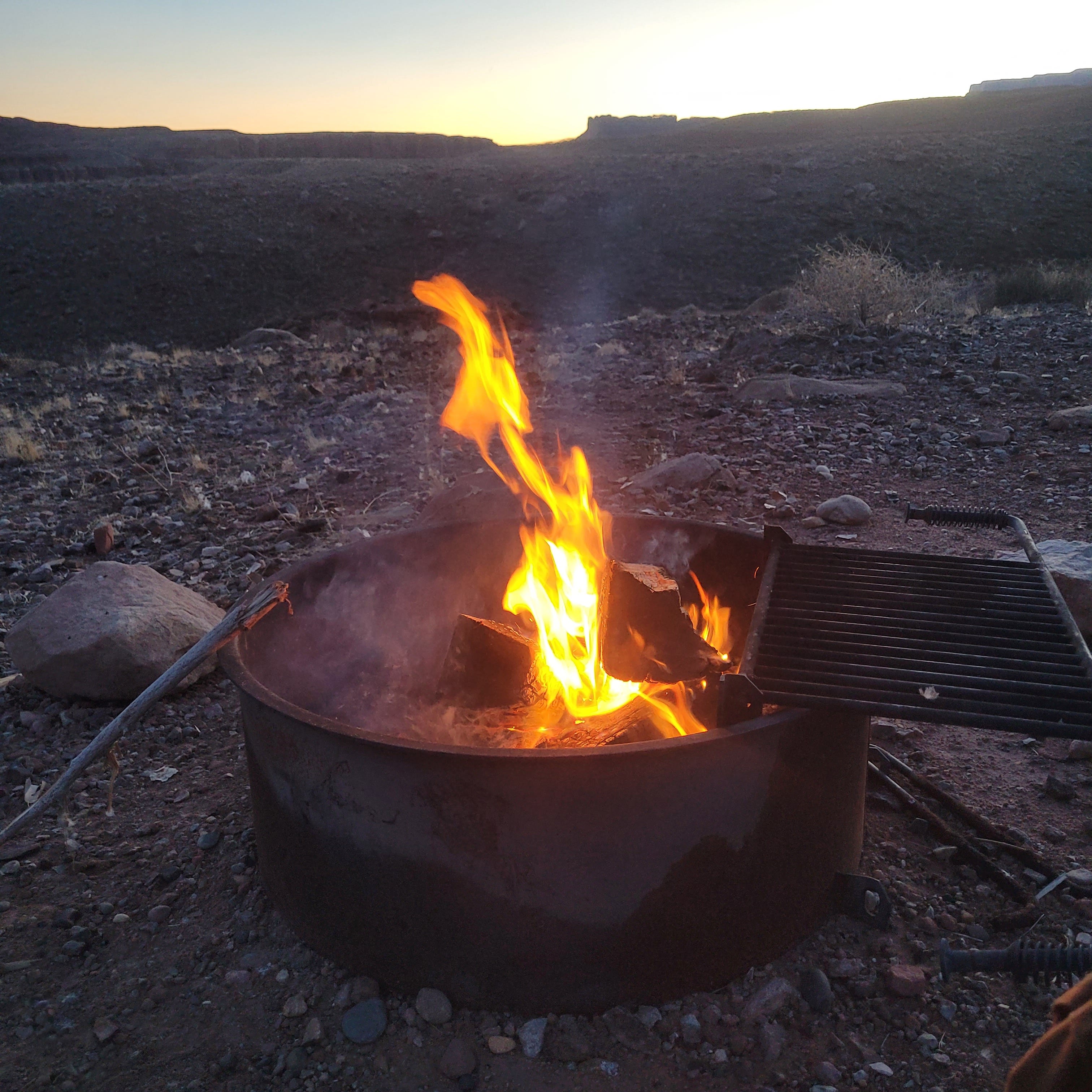
Echo and I camp that night next to the Colorado. We eat hearty but tasteless freeze-dried slop and retire with the sun. Up early and away the next morning, we load Big Red and are off to Canyon De Chelly, smack in the middle of Navajo Nation.
We drive up and out of the Colorado River basin and around snow-frosted Navajo Mountain to get there. A young Navajo man I spoke to at a gas stop called it “our” mountain.
It took three hours to buzz across the high desert reservation to Chinle, Arizona. HUD houses, Hogans, junk cars, and RVs spot the route. Sometimes, four or five homes are gathered together; sometimes, a house stands alone a mile from the road. Gravel roads intersect the highway and lead to god knows where. Ramshackle stands sell Navajo jewelry, art, and rugs close to Page, AZ, and the tourist thoroughfares. On this cold winter day, they are all empty. There are no stands on this road in the outback.
Canyon De Chelly is a network of 1000-foot-deep defiles cut in a red rock plateau by Chinle Creek. While it is a US National Monument, it is owned by the Navajo. Access to the canyon’s floor is limited and only possible with a certified Navajo guide. You can drive the North and South rims of the canyon and view the interior from eight scenic turnouts.
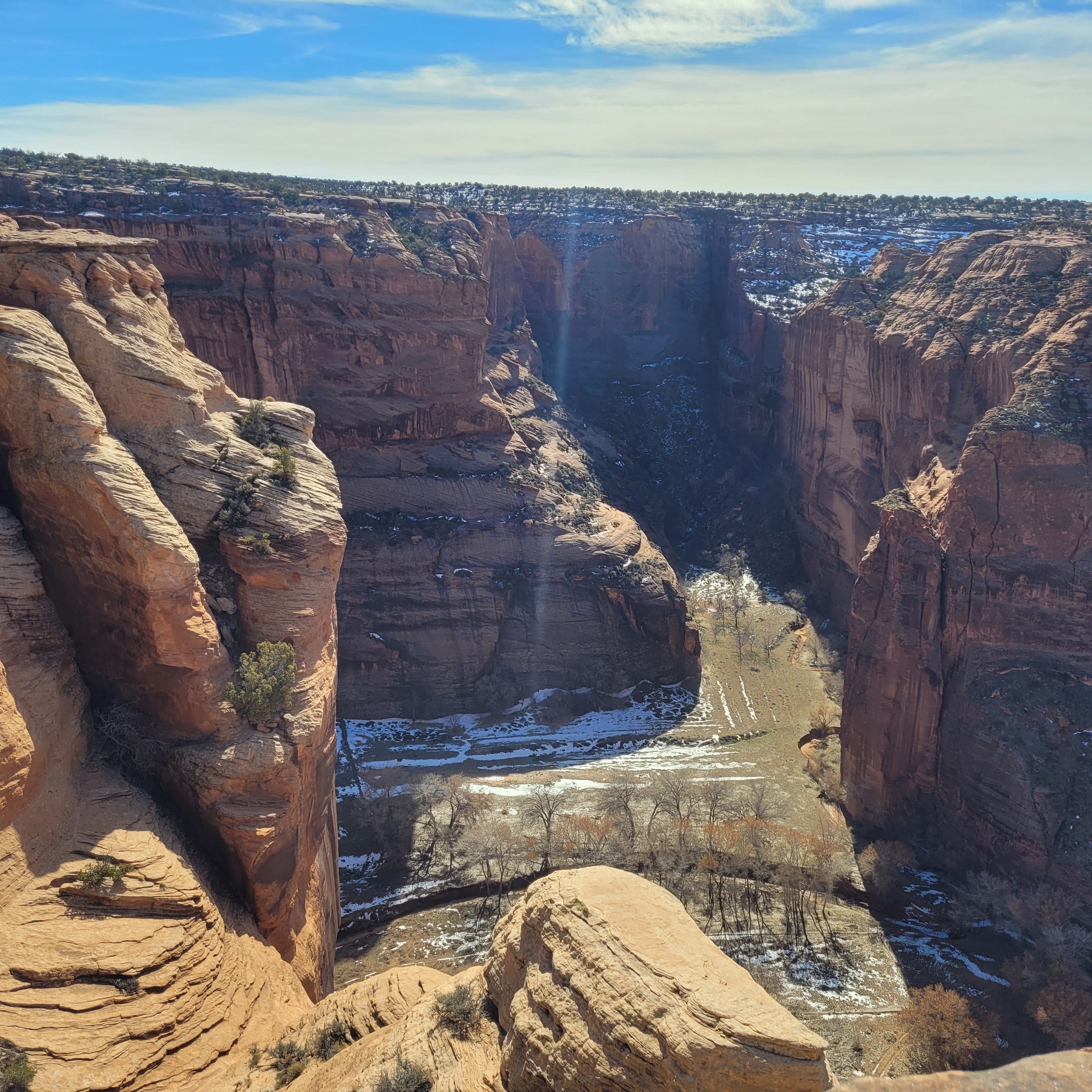
Of course, it's spectacular. Ancestral Pueblo ruins can be seen inside caves and below cliffs. One thousand feet below lie snowy alfalfa fields. There are no paved roads or houses, just the ruins, the creek, and fields farmed since the Pharaohs ruled Egypt.
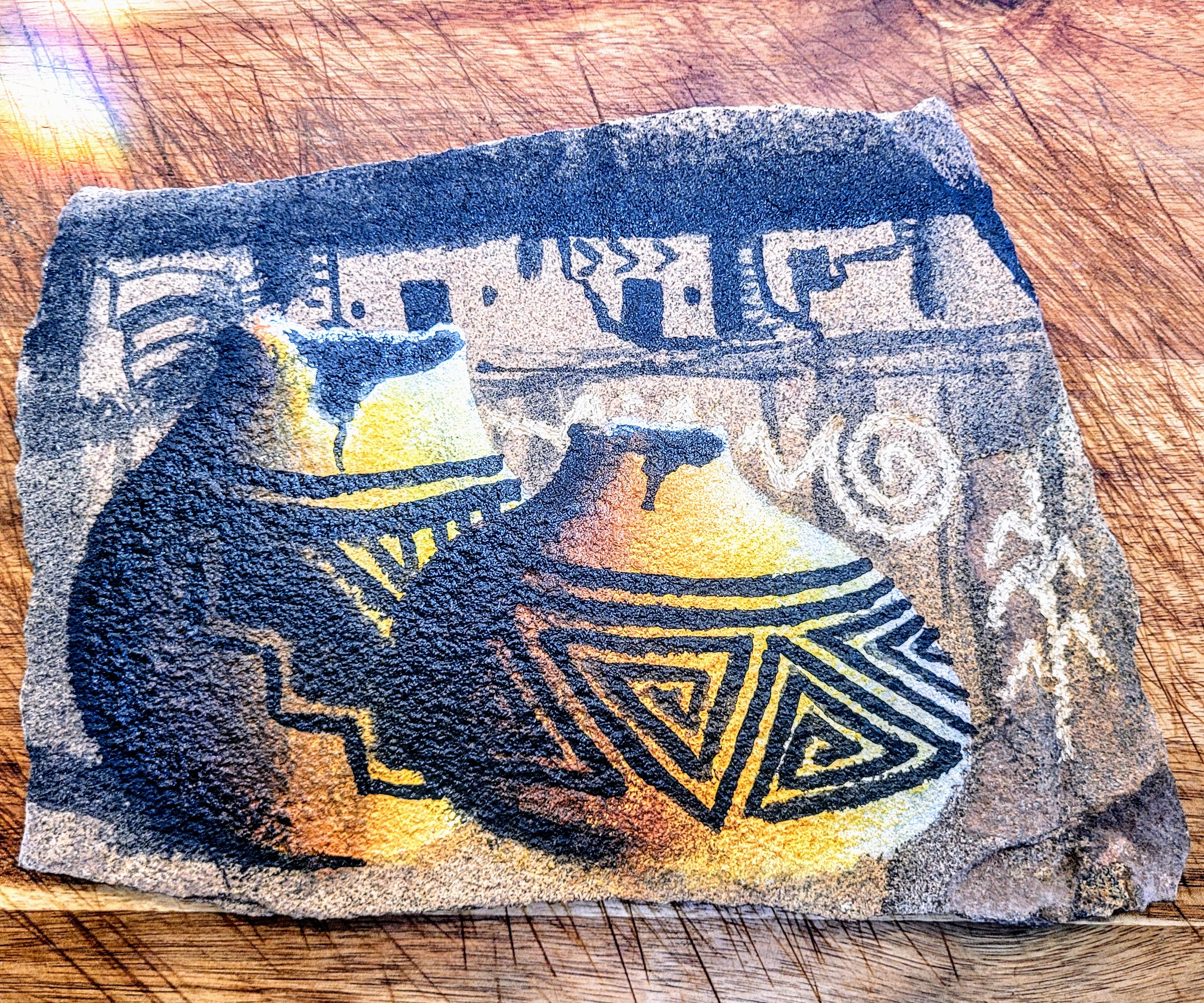
There were Navajo vendors at one of the turnouts, and I bought a bracelet and a remarkable painting on a piece of sandstone for Dawn. The vendors - both men - were quiet, gentle folk proud of their art, heritage, and home.
Night-time temperatures dipped into the teens, so we stayed at the Thunderbird Inn at the mouth of the canyon. The Inn is owned and operated by the Navajo and is terrific. The young front desk clerk wore a Covid mask and two long braids. Navajo Nation was devastated by the pandemic, had one of the highest rates of infection and mortality, and at one point, they completely isolated themselves from the rest of the world. The clerk was wary of an unmasked white guy and frosty at first. But I respected his caution, stayed back from the desk to give appropriate separation, and he softened. He gave me the keys and recommended the fresh salad served from the hotel restaurant - which was delicious.
Our history with the Navajo people is vile and reprehensible. During and after the Civil War, the Federal government carved states out of the western territories to claim them for the Union and deny them to the Confederacy. They used irregular paramilitary forces unleashed on indigenous tribes to force them off their homelands. Against the Navajo (Dine), they used scorched earth tactics to subdue and destroy them. In the words of Kit Carson, leading the assault in 1864 - “They must have been without any description of food. This is owing to the destruction of their grain [corn] amounting to about two Million of Pounds by my command . . . which they depended on for their Winter’s Sustenance. . . . The generality of the Navajos are completely destitute.”
Between 1864 and 1866, the US government forcibly deported and ethnically cleansed the Navajo people. They were forced to walk from western New Mexico territory (modern Arizona) to an internment compound at Bosque Redondo in Eastern New Mexico.
Thousands died.
A subsequent treaty in 1868 allowed the Dine to return to the present reservation within their four sacred mountains but a fragment of their original homelands (Dinetah). In exchange, the Dine agreed to allow railroads, military facilities, wagon roads, and government offices to be built on their land. They agreed not to leave the reservation. They agreed not to attack travelers passing through their reservation. And they agreed that their children between the ages of 6 and 16 would attend a school and complete the “elementary branches of an English education.”
In other words, you can have a portion of your land back, provided you give us full access and military control and allow us to indoctrinate your children.
We are lucky the Dine allow us on their reservation at all, let alone treat us as guests.
After Canyon de Chelly, I decided to run down to Tucson for a couple of days. Tucson has my attention as a possible southern terminus, and I wanted to see if it still held the same allure. Plus, it was 75 degrees and sunny.
It allures no more. The last time I visited - two years ago in pandemic times - it was a busy hive but manageable. Now, after a full Covid recovery, Tucson is a roaring mechanical nightmare. Sure, it still features excellent art, murals, architecture, and diversity. But, Christ…the traffic and the noise! Even after a fabulous Guadalajara burrito bowl, the insane howl outside was unbearable—it was time to get back to the drippy PNW.
So, three brutal 10-hour days later, driving like a trucker, Echo and I pulled back into Pioneer Trails RV park and stopped Big Red next to the hacienda. The odometer says 310660 - just over 4000 miles in 10 days.
With a vagabond heart and eyes full of blue skies.
.